
VA-NC border to Currituck Beach Light, NC out 20 nm Marine Forecast
| This Afternoon...S Winds 5 To 10 Kt, Increasing To 10 To 15 Kt Late This Afternoon. Seas 2 To 3 Ft. Wave Detail: Se 2 Ft At 7 Seconds And Ne 1 Foot At 10 Seconds. |
| Tonight...S Winds 10 To 15 Kt With Gusts Up To 20 Kt. Seas 2 To 3 Ft. Wave Detail: Se 3 Ft At 7 Seconds And Ne 1 Foot At 10 Seconds. |
| Fri...S Winds 10 To 15 Kt With Gusts Up To 20 Kt. Seas 2 To 3 Ft. Wave Detail: Se 2 Ft At 7 Seconds And E 1 Foot At 10 Seconds. |
| Fri Night...Sw Winds 10 To 15 Kt With Gusts Up To 20 Kt. Seas 2 To 3 Ft. Wave Detail: Se 3 Ft At 8 Seconds And E 1 Foot At 10 Seconds. |
| Sat...Sw Winds 10 To 15 Kt With Gusts Up To 20 Kt. Seas 2 To 3 Ft. Wave Detail: Se 3 Ft At 8 Seconds. |
| Sat Night...Sw Winds 10 To 15 Kt With Gusts Up To 20 Kt. Seas 2 To 3 Ft. Wave Detail: Se 3 Ft At 8 Seconds. |
| Sun...Sw Winds 10 To 15 Kt, Becoming S 5 To 10 Kt In The Afternoon. Seas 2 To 3 Ft. |
| Sun Night...Sw Winds 5 To 10 Kt With Gusts Up To 15 Kt. Seas Around 2 Ft. |
| Mon...Sw Winds 5 To 10 Kt With Gusts Up To 15 Kt. Seas Around 2 Ft. |
| Mon Night...Sw Winds 10 Kt With Gusts Up To 15 Kt. Seas Around 2 Ft. |
| Area Forecast Discussion National Weather Service Wakefield VA 116pm EDT Thu August 6 2026 .WHAT HAS CHANGED... Afternoon full discussion/aviation update. No significant changes to the forecast. .KEY MESSAGES... 1) Near normal temperatures and isolated to widely scattered afternoon/evening showers and storms are expected to continue through the weekend. As of 115pm EDT Thursday... KEY MESSAGE 1...Near normal temperatures and isolated to widely scattered afternoon/evening showers and storms are expected to continue through the weekend. Early afternoon weather analysis shows high pressure at the surface and aloft anchored off the Mid-Atlantic/Southeast coast, with upper troughing in the Plains and Midwest. It is a bit hotter than it has been, with heat indices around 100F near the coast and 90s inland. Despite the building heights, a few showers have developed across E/SE NC (south of the FA). Some of this convection could make it into NE NC and perhaps extreme SE VA later this aftn/this evening, but most areas should remain dry. The convection near the coast should dissipate by 7-8pm at the latest. Another area of showers/thunderstorms currently to our NW (over the mountains) will slowly move east but will likely weaken before getting to the area. Still, can't rule out an isolated storm or two across the Piedmont this evening. There is an outside chance of a stronger storm or two across far W/NW portions of the FA, but confidence in this is very low. Similar conditions are expected Friday into the weekend (except that temps may be a couple degrees warmer). A few locations near the VA/NC coast could see brief 105F heat indices each day, but not expecting this to be enough to warrant an advisory. Still expect to see some slight height falls over the local area as the upper ridge offshore retreats a bit to the SE and a series of weak shortwaves pass by to our N/NW. This will lead to slightly greater chances for diurnally driven showers or storms on Friday and Saturday across western and northern portions of the area but Probability of Precipitation generally remain aob 50%. A few storms are possible on Sunday, with the highest precipitation chances (still only ~30%) shifting to SE VA/NE NC. It may be even hotter (with continued humid weather and minimal precipitation chances) on Mon/Tuesday ahead of an approaching front. There is a low chance of Heat Advisory conditions across SE portions of the FA early next week. Marine As of 115pm EDT Thursday... Key Message: - Benign marine conditions are expected to prevail through the weekend and into early next week. High pressure is centered offshore this afternoon. The wind is primarily SSW 10-15kt with 2-3ft seas, and 1-2ft waves in the Ches. Bay. High pressure is expected to prevail off the Southeast coast through the end of the week, into next weekend and early next week. The wind is expected to gradually shift to S/SSE later this afternoon and evening due to seabreeze influences and increase to ~15kt in the Ches. Bay and 15-20kt in the coastal waters, before shifting to SW and relaxing to 10-15kt overnight into Friday morning. A similar pattern is expected Friday and Saturday with a wind shift to S/SSE during the late aftn/evening hours and an increase in speed to ~15kt in the Ches. Bay and 15-20kt in the coastal waters. The pressure gradient relaxes Sunday into early next week with a S/SW wind diminishing to ~10kt or less, which will allow for more of a true sea-breeze with the wind shifting to SE near the coast during the aftn/early evening hours. Seas through the forecast period will primarily be 2-3ft for the coastal waters, ~3ft for the offshore waters, and 1ft to occasionally 2ft waves in the Ches. Bay. NOAA Wakefield VA Office: Watches - Warnings - Advisories MD...None. NC...None. VA...None. Marine None. |
 Newport NC Radar
 Southeast Radar
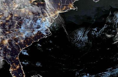 East Coast Satellite