
Tidal Potomac from Indian Head to Cobb Island MD Marine Forecast
| Overnight...N Winds 5 Kt. Waves Less Than 1 Ft. A Slight Chance Of Showers. |
| Sat...E Winds Around 5 Kt. Waves 1 Ft. |
| Sat Night...Se Winds Around 5 Kt. Waves 1 Ft. |
| Sun...S Winds 5 To 10 Kt. Waves 1 Ft. Showers Likely With A Chance Of Tstms. |
| Sun Night...Sw Winds 5 To 10 Kt. Waves 1 Ft. Showers Likely With A Chance Of Tstms. |
| Mon...Nw Winds 5 To 10 Kt. Waves 1 Ft. |
| Mon Night...Nw Winds Around 5 Kt. Waves 1 Ft. |
| Tue...N Winds Around 5 Kt. Waves 1 Ft. |
| Wed...S Winds Around 5 Kt. Waves 1 Ft. Winds And Waves Higher And Visibilities Lower In And Near Tstms. |
| Area Forecast Discussion National Weather Service Baltimore MD/Washington DC 154am EDT Sat August 15 2026 .WHAT HAS CHANGED... Updated to add a Key Message about dense river valley fog. .KEY MESSAGES... - 1) Dense river valley fog early this morning. - 2) Severe thunderstorms and some instances of flash flooding are possible on Sunday. - 3) Seasonably warm conditions and daily shower and thunderstorm chances are expected through Monday, before another round of storms are possible on Thursday. KEY MESSAGE 1...Dense river valley fog early this morning. A combination of clearing skies, abundant low-level moisture in part due to recent rain, and calm winds is resulting in areas of fog this morning in the river valleys of western MD, eastern WV and into the northern Shenandoah Valley in VA. Some of this fog has become dense with visibility down to one quarter mile. Just across the border in PA, some areas are seeing visibility as low as just a few hundred feet. Fog will likely persist/expand through daybreak before slowly burning off. For now, a Dense Fog Advisory is in effect until 9 AM for Allegany, Garrett, Hampshire, and Mineral Counties where dense fog is most widespread. But, this advisory may very well need to be extended/expanded south and east. KEY MESSAGE 2...Severe thunderstorms and some instances of flash flooding are possible on Sunday. Some residual convective activity may be ongoing on Sunday morning. This remains to be seen and will be guided by the degree of overnight instability and boundary placement. How the atmosphere recovers through the day should ultimately dictate the degree of severe thunderstorm threat during the core diurnal heating hours. The ingredients are certainly present for a more impactful event if meteorological parameters all come together. Looking a bit more closely at this event, a broad mid/upper ridge persist across the Four Corners eastward to the southwestern Atlantic. Amplified flow north of this expansive anticyclone will continue to be a conduit to active convection, many in the form of mesoscale convective systems (MCS). As mentioned above, a remnant MCS (Mesoscale Convective System, a complex of thunderstorms which becomes organized on a scale larger than the individual thunderstorms) might still be ongoing early Sunday across the region. While above average heigheights persist, expect some non-zero height falls to cross the area in response to an approaching shortwave. Within this northwesterly flow aloft, vertical shear is ample for the time of year, generally around 30 to 35 knots. Depending on model choice, mixed-layer CAPE values approach 1,500 to 2,500 J/kg. The combination of these two will easily support a risk of severe weather. While damaging wind gusts are the most likely threat, other severe types loom if storms can remain discrete in nature. Additionally, a Slight Risk for excessive rainfall continues along much of the Alleghenies eastward along/north of I-66/U.S. 50. Precipitable water values rise markedly, possibly into the 2 to 2.25 inch range. While a single thunderstorm will be capable of torrential downpours, the bigger threat would be for repeat and/or training convection. The latter potential exists which supports the flash flood risk. Although drought continues over much of the region, many areas have seen a one category improvement over the past week. Convection will likely be ongoing into Sunday night with the cold front not passing through until early Monday. KEY MESSAGE 3...Seasonably warm conditions and daily shower and thunderstorm chances are expected through Monday, before another round of storms are possible on Thursday. High pressure building across southern Quebec down into New England will favor a mostly quiet day for the area today. An onshore component to the winds should favor a mix of clouds and sun through the day. Highs will rise into the mid/upper 80s with any shower/thunderstorm chances confined to the Potomac Highlands across the central Shenandoah Valley toward I-64. Recent high-resolution models are showing an MCS racing across the Ohio Valley late today. Some of this could leak across the Alleghenies, but confidence is low given a fairly mixed model signal. As Sunday's cold front tracks offshore, upper-level zonal flow bringing drier air from the Great Lakes persists over the Mid- Atlantic through midweek, creating a break in the rain and thunderstorms. While temperatures & dewpoints drop a few degrees by Tuesday in the wake of the front, temperatures should gradually increase again in the latter half of the week as high pressure builds overhead. Meanwhile, an upper-level trough will begin to form over the Northern Plains and then track across the Great Lakes late in the week, with a strong cold front potentially moving through the Mid- Atlantic between Thursday and Friday. Medium-range algorithms are already highlighting a potential for severe thunderstorms with this system. However, severe probabilities currently vary widely across models, with CSU ML probabilities highlighting only a marginal 5%- 15% probability as of the 12Z model runs while the WxNext2 Mean AI outlook is already showing a 30%-45% probability. Deterministically, the GFS/ECMWF (European Centre for Medium-Range Weather Forecasts) also have not quite aligned on the timing and placement of the trough 7 days out. Should this setup materialize, storms capable of heavy downpours and damaging winds would be possible. As drought conditions continue to improve area-wide, localized flooding becomes more of a concern with any thunderstorms that form in the region. For now, this will be a feature to continue to monitor as the synoptic setup becomes more defined. Marine Background wind fields remain below advisory threshold through early Sunday. Ahead of a cold front, southerly winds increase in earnest which will carry gusts to around 20 to 25 knots. This likely requires Small Craft Advisories from Sunday afternoon into the overnight hours. Additionally, there will be an increasing risk of strong to severe thunderstorms, many of which may need Special Marine Warnings. Sunday likely presents itself as the most hazardous day to be on the waters, particularly from the afternoon onward. Convection may continue into Monday morning before the storm threat and winds drop off through the day. Winds stay below SCA (Small Craft Advisory) thresholds on Tuesday. Beginning Wednesday afternoon, wind gusts pick up to marginal SCA (Small Craft Advisory) thresholds before diminishing overnight. Northwest winds shift southeast by Wednesday morning. Tides / Coastal Flooding Water levels are largely expected to stay below Action Stage through Saturday. The potential exception could be Annapolis, which could reach Action Stage at the higher of the daily tides. Water levels will start to increase in southerly flow on Sunday, with Annapolis potentially approaching Minor Flood Stage. NOAA Baltimore MD/Washington DC Office: Watches - Warnings - Advisories DC...None. MD...Dense Fog Advisory until 9am EDT this morning for MDZ501-502- 509-510. VA...None. WV...Dense Fog Advisory until 9am EDT this morning for WVZ050-503- 504. Marine None. |
 Baltimore/Washington Radar
 Northeast Radar
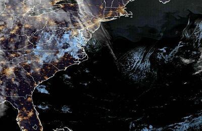 East Coast Satellite