
Port Mansfield, TX to the Rio Grande River Marine Forecast
| Today...Southeast Winds 10 To 15 Knots. Seas 2 To 3 Feet. Wave Detail: Southeast 2 Feet At 4 Seconds And East 1 Foot At 8 Seconds. |
| Tonight...Southeast Winds 10 To 15 Knots. Seas 2 To 3 Feet. Wave Detail: Southeast 2 Feet At 4 Seconds And East 1 Foot At 7 Seconds. |
| Thursday...Southeast Winds 10 To 15 Knots. Seas 2 To 3 Feet. Wave Detail: Southeast 2 Feet At 5 Seconds. |
| Thursday Night...Southeast Winds 10 To 15 Knots. Seas 2 To 3 Feet. Wave Detail: Southeast 2 Feet At 5 Seconds. |
| Friday...South Winds 10 To 15 Knots. Seas 2 To 3 Feet. Wave Detail: Southeast 2 Feet At 5 Seconds. |
| Friday Night...South Winds 10 To 15 Knots, Becoming Around 10 Knots Early In The Morning. Seas 2 To 3 Feet. Wave Detail: Southeast 2 Feet At 6 Seconds. |
| Saturday...South Winds 5 To 10 Knots, Becoming Southeast 10 To 15 Knots Late In The Afternoon. Seas 2 To 3 Feet. |
| Saturday Night...South Winds 10 To 15 Knots, Becoming Around 10 Knots Early In The Morning. Seas 2 To 3 Feet. |
| Sunday...South Winds 5 To 10 Knots, Becoming Southeast In The Afternoon. Seas 2 To 3 Feet. |
| Sunday Night...Southeast Winds 10 To 15 Knots, Becoming South Early In The Morning. Seas 2 To 3 Feet. |
| Area Forecast Discussion ...UPDATED National Weather Service Brownsville TX 602am CDT Wednesday August 19 2026 Issued at 1033pm CDT Tuesday August 18 2026 The persistent 500mb ridge over the Four Corners extending into Texas will provide strong subsidence across the region through late week. The mid-level ridge will then build farther eastward over west Texas this weekend into early next week. Therefore, hot and rain- free conditions are forecast to continue through forecast period. Daily high temperatures are expected to range from the the upper 90s to around 105 degrees, except near the coast. The combination of hot temperatures and elevated dewpoint temperatures in the 70s will support heat indices generally between 105 to 110 degrees each afternoon. Heat indices may briefly reach 111+ at a few locations in the afternoon, especially Thursday and Friday. Widespread Moderate (Level 2 of 4) to Major (Level 3 of 4) Heat Risk expected through late week into the weekend. Whether a Special Weather Statement (SPS) or a Heat Advisory is issued for portions of the area, be sure to exercise caution if spending time outdoors and always look before you lock. The hot, dry, and at times breezy conditions will support the potential increase of fire weather concerns Wednesday and Thursday. Minimum relative humidity below 30 percent is expected each afternoon, mainly along and west of I-69C/US 281. Generally low to marginally moderate rip current risk is forecast through the rest of the week and into the weekend. Marine Issued at 1033pm CDT Tuesday August 18 2026 Generally favorable marine conditions will prevail along the Lower Texas Coast through the period with light to moderate winds and seas of 2 to 3 ft. However, winds may increase to 15 to 20 kts over the Laguna Madre Wednesday into Friday, which could lead to Small Craft Should Exercise Caution conditions. NOAA Brownsville TX Office: Watches - Warnings - Advisories None. |
 Brownsville TX Radar
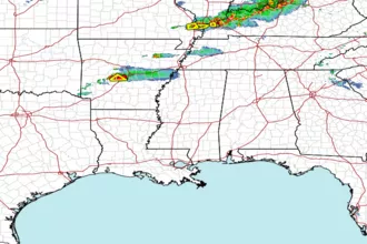 Gulf Radar