
New York Harbor Marine Forecast
| Rest Of Today...Se Winds 5 To 10 Kt. Waves 1 Ft Or Less. Slight Chance Of Showers. Slight Chance Of Tstms Late. |
| Tonight...S Winds 5 To 10 Kt, Becoming Sw After Midnight. Waves 1 To 2 Ft. Slight Chance Of Showers And Tstms. |
| Thu...S Winds 5 To 10 Kt. Waves 1 Ft Or Less, Then 1 To 2 Ft In The Afternoon. Slight Chance Of Showers And Tstms In The Afternoon. |
| Thu Night...Sw Winds 5 To 10 Kt. Waves 1 To 2 Ft. Chance Of Showers And Tstms In The Evening, Then Slight Chance Of Showers After Midnight. |
| Fri...Sw Winds Around 5 Kt. Waves 1 Ft Or Less. Showers Likely With Chance Of Tstms In The Afternoon. |
| Fri Night...Sw Winds 5 To 10 Kt. Waves 1 Ft Or Less. Showers Likely With Chance Of Tstms In The Evening, Then Chance Of Showers After Midnight. |
| Sat...Sw Winds 5 To 10 Kt. Waves 1 Ft Or Less. Chance Of Showers And Tstms In The Afternoon. |
| Sat Night...Sw Winds 5 To 10 Kt. Waves 1 To 2 Ft. |
| Sun...W Winds 5 To 10 Kt. Waves 1 To 2 Ft. |
| Sun Night...W Winds 5 To 10 Kt. Waves 1 Ft Or Less. |
| Mon...Sw Winds 5 To 10 Kt. Waves 1 Ft Or Less. |
| Mon Night...W Winds 5 To 10 Kt. Waves 1 Ft Or Less. Winds And Waves May Be Higher In And Near Tstms. |
| Area Forecast Discussion National Weather Service New York NY 1137pm EDT Wednesday August 5 2026 .WHAT HAS CHANGED... Heat Advisory issued for the entire area Thursday and Friday. .KEY MESSAGES... 1. Very warm and humid through the weekend, possibly lingering into the start of next week. 2. Potential for mainly afternoon/early evening heavy downpours through Saturday. .KEY MESSAGE 1... An anomalously strong subtrop ridge will be in control of the weather through Friday before breaking down late Friday into the weekend as the westerlies once again drop back into the area. Before then though, a deep-layered S/SW flow will bring very humid air into the region along with temperatures several degrees above normal. While daytime highs will fall well below records, the high humidity will make it feel quite uncomfortable. Heat index values on Thursday are forecast to get to around 100, with slightly lower values on Friday. Thus, a heat advisory has been issued for the area for both days, based on two consecutive days of heat index values 95 and above. Highs Thursday and Friday will be in the mid 80s to around 90, with lows in the 70s. The low temperatures will be closer to records, but still look to fall several degrees below. As we get into the weekend and early next week, temperatures are forecast to be similar, but with gradually lowering humidity. Heat advisories for some locations may need to be extended into Saturday. Beyond that time, it looks very marginal. .KEY MESSAGE 2... Along with the very warm and humid airmass will come the chance of showers and thunderstorms. The airmass will gradually destabilize over the next couple of days with disturbances in the SW flow aloft. The best chance will be during the afternoon and evening hours, mainly for NYC and points north and west. Friday has the potential to be a more widespread event. Heavy downpours are likely with any showers and thunderstorms with high PW values (Precipitable Water values) around 2 inches. Isolated pulse severe storms can't be ruled out, but wind shear and mid-level lapse rates are weak. WPC has much of the area under a marginal risk for excessive rainfall Thursday and Friday. This is for isolated instances of flash flooding. Marine A prolonged period of SW flow will feature gusts to around 20 kt on the ocean waters late day into the first half of the night Thursday through Saturday. At this time, seas are forecast to remain below SCA (Small Craft Advisory) criteria. Rip Currents A moderate rip current risk is expected through this evening as S swells continue to subside. The moderate risk should continue through most of Thursday, however it may increase to high at some beaches toward evening as southerly winds and swells increase. NOAA New York NY Office: Watches - Warnings - Advisories CT... Heat Advisory from 11am Thursday to 8pm EDT Friday for CTZ005>012. Air Quality Alert from 11am to 11pm EDT Thursday for CTZ009- 010. NY... Heat Advisory from 11am Thursday to 8pm EDT Friday for NYZ067>075-078>081-176>179. NJ... Heat Advisory from 11am Thursday to 8pm EDT Friday for NJZ002-004-006-103>108. Marine None. |
 New York Radar
 Northeast Radar
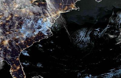 East Coast Satellite