
Narragansett Bay Marine Forecast
| Today...Sw Winds 5 To 10 Kt. Waves Around 2 Ft. |
| Tonight...Sw Winds 5 To 10 Kt. Waves Around 2 Ft. |
| Sat...Sw Winds 5 To 10 Kt, Increasing To 10 To 15 Kt With Gusts Up To 20 Kt In The Afternoon. Waves 2 To 3 Ft. Patchy Fog In The Morning. |
| Sat Night...Sw Winds 10 To 15 Kt With Gusts Up To 20 Kt, Diminishing To 5 To 10 Kt After Midnight. Waves 2 To 3 Ft. |
| Sun...Sw Winds 5 To 10 Kt, Increasing To 10 To 15 Kt With Gusts Up To 20 Kt In The Afternoon. Waves Around 2 Ft. |
| Sun Night...W Winds 5 To 10 Kt. Waves Around 2 Ft. |
| Mon And Mon Night...Sw Winds 10 To 15 Kt. Gusts Up To 20 Kt. Waves Around 2 Ft. |
| Tue And Tue Night...W Winds 10 To 15 Kt With Gusts Up To 20 Kt. Waves 2 To 3 Ft. A Chance Of Showers. Seas Are Reported As Significant Wave Height, Which Is The Average Of The Highest Third Of The Waves. Individual Wave Heights May Be More Than Twice The Significant Wave Height. |
| Area Forecast Discussion National Weather Service Boston/Norton MA 438am EDT Fri August 7 2026 .WHAT HAS CHANGED... No significant changes. Although it remains very warm into the weekend, the level of heat does begin to drop off so the current thought is to not extend the Heat Advisory beyond Friday. .KEY MESSAGES... - Advisory level heat continues today, with high humidity lingering through the weekend. - Diurnal shower and thunderstorm chances remain a threat through Saturday, with dry weather returning Sunday. - Unsettled weather may return early next week, as well as continuing high humidity. KEY MESSAGE 1...Advisory level heat continues today, with high humidity lingering through the weekend. As expected, temperatures tonight remain elevated.... right around 74 for a low. Dewpoints are also remaining elevated, around 72, and a layer of fog has developed along the South Coast, Cape/Islands, and in the CT River Valley. Similar to yesterday, it'll take a bit of sun power to burn off given how tropical an airmass we have sitting over us. Temperatures are expected to surge again today, topping out in the upper 80s to low 90s, with 925mb temps around +25C this afternoon. With the prolonged southerly flow, dewpoints will be on the rise again today as well... right around 73-74, leading to "feels like" temperatures to soar into the upper 90s, near 100 at times. Also expecting little to no relief tonight as temperatures will once again remain in the low 70s with dewpoints not much lower. Saturday and Sunday look to be just slightly cooler, with temperatures around 2-4 degrees less. Unfortunately, the humidity will hang around through the weekend, leading to "feels like" temperatures to remain in at least the low 90s. Heat Advisories remain in effect through at least this evening. KEY MESSAGE 2...Diurnal shower and thunderstorm chances remain a threat through Saturday, with dry weather returning Sunday. Unsettled weather may return early next week, as well as continuing high humidity. While a low-level warm layer will likely keep most storms from firing during the day, CAM guidance is suggesting a possible line of thunderstorms moving through the western/interior portion of southern New England later this evening/tonight. Notably, the HRRR (High-Resolution Rapid Refresh) Neural Network's 03z run has significantly reduced chances for severe storms as far east as Hartford/CT River Valley compared to the 00z run. Highest chances of severe thunderstorms remain in northern NJ/NYC metro, but cannot rule out 1 or 2 possibly severe storms in western CT/MA tonight. Saturday still looks to have the best chances for scattered thunderstorms across southern New England, with roughly the same set- up as today. Highest chances will once again be in the late evening/post-sunset hours, with model guidance honing in on a more robust line pushing through the NYC metro and southern/western portion of CT. Any thunderstorms that do Probability of Precipitation both today and Saturday have the potential to produce frequent lightning, gusty winds, and torrential downpours. PWATs (Precipitable Waters) will likely be near 2.0" off and on through the weekend. Model soundings also indicate the mid-level steering flow could be rather week, leading to slow moving storms or even training. Given the amount of rain southern New England has seen over the last week or two, any heavy downpours could lead to localized flooding. KEY MESSAGE 3...Unsettled weather may return early next week, as well as continuing high humidity. Expecting a few more shortwaves to move through the upper-level flow as well as a trailing cold front early next week, bringing additional chances for showers to southern New England Monday night into Tuesday. The FROPA could bring a small amount of relief from the heat for the start of the next work week, knocking dewpoints down to the high 60s instead of mid 70s, but humidity levels likely will remain elevated through mid-week. Marine Forecaster Confidence Levels... Low - less than 30 percent. Moderate - 30 to 60 percent. High - greater than 60 percent. Through Saturday... High Confidence. No significant changes to the forecast. Overall weather pattern shows a large area of high pressure off the east coast. This will continue to produce a SW flow across the entire region into the weekend. Outlook /Saturday Night through Tuesday/... Saturday Night: Winds less than 25 kt. Seas up to 5 ft. Slight chance of rain showers. Sunday through Sunday Night: Winds less than 25 kt. Areas of seas approaching 5 ft. Monday through Monday Night: Winds less than 25 kt. Tuesday: Winds less than 25 kt. Areas of seas approaching 5 ft. Slight chance of rain showers. NOAA Boston MA Office: Watches - Warnings - Advisories CT... Heat Advisory until 8pm EDT this evening for CTZ002>004. MA... Heat Advisory until 8pm EDT this evening for MAZ003>007- 010>021-026. RI... Heat Advisory until 8pm EDT this evening for RIZ001>007. Marine None. |
 Boston MA Radar
 Northeast Radar
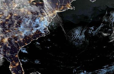 East Coast Satellite