
Albemarle Sound Marine Forecast
| Overnight...S Winds 5 To 10 Kt. Waves 1 Ft Or Less. |
| Thu...Sw Winds 5 To 10 Kt. Waves 1 Ft Or Less. A Slight Chance Of Showers In The Afternoon. |
| Thu Night...Sw Winds Around 10 Kt. Waves 1 Ft Or Less. |
| Fri...Sw Winds 5 To 10 Kt. Waves 1 Ft Or Less. |
| Fri Night...Sw Winds 10 To 15 Kt. Waves Around 2 Ft In The Evening, Then 1 Ft. |
| Sat...Sw Winds Around 10 Kt. Waves 1 Ft Or Less. |
| Sat Night...Sw Winds 10 To 15 Kt. Waves Around 2 Ft. |
| Sun...Sw Winds 5 To 10 Kt. Waves 1 Ft Or Less. A Chance Of Showers And Tstms In The Afternoon. |
| Sun Night...Sw Winds 5 To 10 Kt. Waves 1 Ft Or Less. A Chance Of Showers And Tstms In The Evening. |
| Mon...Sw Winds 5 To 10 Kt. Waves 1 Ft Or Less. |
| Mon Night...Sw Winds 5 To 10 Kt. Waves 1 Ft Or Less. Winds And Waves Higher In And Near Tstms. |
| Area Forecast Discussion National Weather Service Wakefield VA 242am EDT Thu August 6 2026 .WHAT HAS CHANGED... Full discussion update. No significant changes to the forecast. .KEY MESSAGES... 1) Near normal temperatures and isolated to widely scattered afternoon/evening showers and storms are expected to continue through the weekend. As of 240am EDT Thursday... KEY MESSAGE 1...Near normal temperatures and isolated to widely scattered afternoon/evening showers and storms are expected to continue through the weekend. High pressure will remain anchored off the Southeast coast through the weekend. The upper ridge offshore will build westward today with modest height rises keeping a lid on widespread convection. 00z models and CAM guidance show the potential for relatively greater shower and storm chances across northeastern NC early this afternoon but Probability of Precipitation remain below 40%. Another area of showers and storms will likely form west and northwest of the local area along the higher Blue Ridge terrain by mid to late afternoon. These storms may just be able to sneak into the far NW and N portions of the area by the evening but most of the region will be dry. With lower storm chances, temps rebound to the upper 80s-lower 90s on today with upper 90s-low 100s heat indices. Similar conditions are expected Friday into the weekend with some slight height falls over the local area as the upper ridge offshore retreats a bit to the SE and a series of weak shortwaves pass by to our N/NW. This will lead to slightly greater chances for diurnally driven showers or storms on Friday and Saturday across western and northern portions of the area but Probability of Precipitation generally remain aob 40%. A few storms are possible on Sunday, with the highest precipitation chances (still only 30-40%) shifting to SE VA/NE NC. Seasonable heat and humidity will continue through the weekend, with heat indices in the upper 90s-low 100s each day. Marine As of 240am EDT Thursday... Key Message: - Benign marine conditions are expected to prevail through the weekend, outside of local thunderstorm influences. An expansive Bermuda high is the main feature influencing winds this morning, and marine observation sites are measuring SW of 10-15 kts, with a few gusts of 15-20 kts. Waves in the Bay are 1-2 ft, and seas in the nearshore coastal waters are 2-3 ft. The same general synoptic set up will linger through the weekend, though a few weak disturbances will move through to our north which could occasionally tighten the gradient further through Saturday. Sub-SCA (Small Craft Advisory) S-SW winds ~10-15 kt are forecast to develop each morning (up to 15-20 kts in the coastal waters), turning S-SE nearshore with seabreeze circulations each afternoon. As the aforementioned high drifts closer to the coast, the gradient will relax and winds of ~10 kts or less are forecast by early next week. Waves in the Bay will remain between 1-2 ft, with seas in the coastal waters ranging between 2-4 ft. Daily afternoon and evening isolated shower and storm chances persist into the weekend. Rip Currents A moderate rip current risk looks to persist across the northern beaches through at least Saturday, with a low risk for the southern beaches. NOAA Wakefield VA Office: Watches - Warnings - Advisories MD...None. NC...None. VA...None. Marine None. |
 Wakefield Norfolk VA Radar
 Northeast Radar
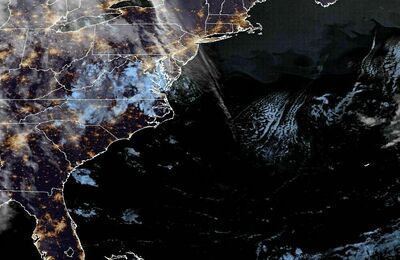 East Coast Satellite